Varieties
The myth of lost civilization
The myth of lost civilization
The island is oblong in shape, with an 8 km diameter in length and a 2.5 km diameter in breadth. Its total surface is 9.3 square kilometers. It shares the same morphology and similar architecture with Thera as to its houses and churches.
According to Greek mythology, the island was named after the younger daughter of King Theras, Therassia, to whom he offered the island to build a majestic palace in the area of Kavos-Korfos.
It is believed that it was formed during the great volcanic eruption of 1600 BC. The famous Greek historian Plinios mentions that in 237 BC it was detached from Santorini after an earthquake.
Ptolemy mentions that Therassia was a city where important prehistoric relics of the Cycladic civilization were found and that throughout history it followed the fate of Thera as its “appendage”. In 1397, the Duke of Naxos Francesco I Crispo is believed to have offered Therassia to his son Marco I Crispo, along with the island of Ios.
In 1866, the mines in Therassia and Thera were in full swing due to exportation of Theran land to Egypt for the construction of the Suez Canal. Some workers in the N. Nomikos-Sigouras Alafouzos mine discovered an ancient building, several pots and a human skeleton.
Doctor and member of the Parliament Nicholaos Nomikos together with Alafouzos made sure of the building’s excavation and relative articles were published in magazines and newspapers. Due to the volcano’s activity during that period, several scientists from all around the world had arrived in the area, among them French volcanologist Fouque who in 1867 excavated in Therassia and studied the ruins of buildings and discoveries –fruits, stone vessels (bowls), utensils and tools, an arrow made of obsidian.
The settlement of Therassia is dated in the Late Bronze Age and these discoveries triggered excavations in Akrotiri and other places of Thera. In fact, in 1867 Fouque himself begun excavations in the region around Akrotiri to find same pieces of vessels as those in Therassia, knives, arrows and two gold rings from a necklace.
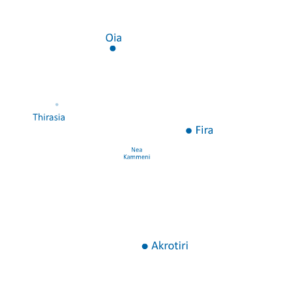
Boats visiting the island tie up at Riva, the port of Therassia. The church of Aghia Irini (Santa Irene) shines white on the hill above. According to a theory, Santorini was named after this small church.
Therasia’s villages are:
Agrilia
It was the largest and oldest village on the island until 1928. Ask the locals to help you explore underground (virtually invisible) rock-hewn houses and old wineries. Panagia Eisodion, or Lagadi (Virgin Mary of the Presentation, or of the Valley) was built at the entrance of Agrilia in 1887. It is interesting in terms of decoration and architecture. The residents or Agrilia are mainly farmers.
Manolas
The capital of the island is built on the rim of its caldera. The view over Santorini is spectacular from here. Manolas is a picturesque village, with narrow cobblestone streets, a traditional bakery, an old grocery store, and the 1874 church of Aghios Konstantinos (Saint Constantine).
Potamos
Built in a gully, this is the first village you will arrive at after you leave Aghia Irini. Several houses here are rock-hewn. At the centre, you will find the churches of Aghios Dimitrios (Saint Demetrius) and Panagia Giatrissa (Virgin Mary the Healer).
You may also visit:
Riva
Here you will find several fish taverns and a pebbly beach. By bus or taxi, you can go from here to the other villages of the island, or, if you prefer, you can follow the rural roads called rimidia.
Kera (or Keradiana)
Located southeast of Manolas, it is perch high up on the cliff, overlooking Palia Kameni and Nea Kameni. The scenery looks even more impressive if you climb up to the small church of Profitis (Prophet) Elias, west of Kera, at an altitude of 270 metres.
Korfos
The old Therassia port where boats taking people from Athinios to the volcano take a stop. If you are already on the island, you can go down the steps to Korfos (270 in total). In Korfos you will find fish taverns.
In Therassia there are: ΑΤΜ, a community clinic, a helipad, coffee houses, mini markets, grocery stores, gift shops, taverns, a bakery, a few rooms to let in Manolas.
You will find taverns in Riva, Manolas, Korfos.
Useful numbers: +30 22860 29143, +30 22860 29238.
Community clinic: +30 22860 29229
Ship timetable (every day)
Departure from Ammoudi (near Oia): 07.50, 12.30
Departure from Athinios (main port): 15.30 (except Sundays)
The island is oblong in shape, with an 8 km diameter in length and a 2.5 km diameter in breadth. Its total surface is 9.3 square kilometers. It shares the same morphology and similar architecture with Thera as to its houses and churches.
According to Greek mythology, the island was named after the younger daughter of King Theras, Therassia, to whom he offered the island to build a majestic palace in the area of Kavos-Korfos.
It is believed that it was formed during the great volcanic eruption of 1600 BC. The famous Greek historian Plinios mentions that in 237 BC it was detached from Santorini after an earthquake.
Ptolemy mentions that Therassia was a city where important prehistoric relics of the Cycladic civilization were found and that throughout history it followed the fate of Thera as its “appendage”. In 1397, the Duke of Naxos Francesco I Crispo is believed to have offered Therassia to his son Marco I Crispo, along with the island of Ios.
In 1866, the mines in Therassia and Thera were in full swing due to exportation of Theran land to Egypt for the construction of the Suez Canal. Some workers in the N. Nomikos-Sigouras Alafouzos mine discovered an ancient building, several pots and a human skeleton.
Doctor and member of the Parliament Nicholaos Nomikos together with Alafouzos made sure of the building’s excavation and relative articles were published in magazines and newspapers. Due to the volcano’s activity during that period, several scientists from all around the world had arrived in the area, among them French volcanologist Fouque who in 1867 excavated in Therassia and studied the ruins of buildings and discoveries –fruits, stone vessels (bowls), utensils and tools, an arrow made of obsidian.
The settlement of Therassia is dated in the Late Bronze Age and these discoveries triggered excavations in Akrotiri and other places of Thera. In fact, in 1867 Fouque himself begun excavations in the region around Akrotiri to find same pieces of vessels as those in Therassia, knives, arrows and two gold rings from a necklace.
Boats visiting the island tie up at Riva, the port of Therassia. The church of Aghia Irini (Santa Irene) shines white on the hill above. According to a theory, Santorini was named after this small church.
Therasia’s villages are:
Agrilia
It was the largest and oldest village on the island until 1928. Ask the locals to help you explore underground (virtually invisible) rock-hewn houses and old wineries. Panagia Eisodion, or Lagadi (Virgin Mary of the Presentation, or of the Valley) was built at the entrance of Agrilia in 1887. It is interesting in terms of decoration and architecture. The residents or Agrilia are mainly farmers.
Manolas
The capital of the island is built on the rim of its caldera. The view over Santorini is spectacular from here. Manolas is a picturesque village, with narrow cobblestone streets, a traditional bakery, an old grocery store, and the 1874 church of Aghios Konstantinos (Saint Constantine).
Potamos
Built in a gully, this is the first village you will arrive at after you leave Aghia Irini. Several houses here are rock-hewn. At the centre, you will find the churches of Aghios Dimitrios (Saint Demetrius) and Panagia Giatrissa (Virgin Mary the Healer).
You may also visit:
Riva
Here you will find several fish taverns and a pebbly beach. By bus or taxi, you can go from here to the other villages of the island, or, if you prefer, you can follow the rural roads called rimidia.
Kera (or Keradiana)
Located southeast of Manolas, it is perch high up on the cliff, overlooking Palia Kameni and Nea Kameni. The scenery looks even more impressive if you climb up to the small church of Profitis (Prophet) Elias, west of Kera, at an altitude of 270 metres.
Korfos
The old Therassia port where boats taking people from Athinios to the volcano take a stop. If you are already on the island, you can go down the steps to Korfos (270 in total). In Korfos you will find fish taverns.
In Therassia there are: ΑΤΜ, a community clinic, a helipad, coffee houses, mini markets, grocery stores, gift shops, taverns, a bakery, a few rooms to let in Manolas.
You will find taverns in Riva, Manolas, Korfos.
Useful numbers: +30 22860 29143, +30 22860 29238.
Community clinic: +30 22860 29229
Ship timetable (every day)
Departure from Ammoudi (near Oia): 07.50, 12.30
Departure from Athinios (main port): 15.30 (except Sundays)
In Therassia there are: ΑΤΜ, a community clinic, a helipad, coffee houses, mini markets, grocery stores, gift shops, taverns, a bakery, a few rooms to let in Manolas.
You will find taverns in Riva, Manolas, Korfos.
Useful numbers: +30 22860 29143, +30 22860 29238.
Community clinic: +30 22860 29229
Ship timetable (every day)
Departure from Ammoudi (near Oia): 07.50, 12.30
Departure from Athinios (main port): 15.30 (except Sundays)
Santorini’s geomorphology is the result of hundreds of thousands of years of volcanic activity.
The island is located on top of the volcanic arc of the Aegean Sea which consists of a series of inactive or active volcanoes spanning approximately 500 km in length and 30-40 km in width. The arc extends from the eastern coast of Greece’s mainland, through to central Aegean Sea and ends at the western coast of Turkey.
The geology of Santorini presents a large variety and wealth.
Prevolcanic are the limestone layers in Prophet Εlias, Monolithos, Gavrilos and the shale rocks in Athinios. Volcanic are the pyroclastics, the lava and the thick layers of Theran earth, which consist the ground of the island. It is as thick as 40 m in the flat land but it is thinner in highlands due to corrosion. It is fertile and favors crops where the economy of the island was based on prior to the development of tourism. Vines, cereals (barley mainly), legumes, fava and, in the older days, cotton have been the basic crops from ancient times.
Santorini is one of the most arid regions of the Aegean Sea, due to lack in underground wells and to very few rainfalls. The climate is temperate and the temperatures are quite high during winter, while in the summer the heat mitigates the wind. This time of season fogs keep moisture in the atmosphere, while many times south winds blow.
In its SE part is located the mountain of Prophet Elias with the homonymous monastery. Next to it is Mesa Vouno where ancient Thera is built.
The eastern side of the island slopes gently to the sea, lined with beaches of black volcanic sand.
* Source: “Santorini: And the sea brought forth the earth”/ Topio Publications/ From the text of archeologist Kiki Birtacha.